Archives
Majuli - Chasing a Dream of a Secured Life
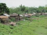
The traditional Mishing bamboo and thatch house on a raised platform of Lakheswar stood on the embankment-cum-road as a testimony of not only a very useful know-how of the Mishing tribe, to which be belongs, in coping with recurring floods but also as a grim reminder of the heavy erosion caused by the River Brahmaputra that forced the tribal family to take shelter on the embankment for last two and half years. There was no prelude and Lakheswar quickly engaged himself in a long conversation with Eastern Panorama perhaps to forget, at least for some time, the pain and agony of not finding any work to earn some money and buy food for his family.
Pointing his finger towards the River Brahmaputra that flows close to his present house on the slope of the embankment, he could still easily locate his plot of 20 bighas (about 7.6 bighas of land form one hectare) of land in his erstwhile village Upar Sonowal; which is now a part of the river, and where he cultivated different summer and winter crops.
 Lakheshwar is one of those thousands of displaced tribal people living in the embankment cum road that connects Kamalabari and Bangaon areas of Majuli – the largest populated river island of and one of the country's bio-diversity and cultural hot spots in Jorhat district of Upper Assam. These marginalised people have been uprooted from their original villages at different times due to flood and erosion, and are settled on slopes of the embankments, without safety, livelihood and social security. Both sides of the road are now home to over several hundreds of displaced families belong to his tribesmen. The thatched roofs of traditional Mishing houses, an architectural beauty, have lost their sheen and are covered with dirt that is sprayed every time a vehicle passes through the potholed embankment-cum-road.
Today, Lakheshwar is a landless person but like many others of his tribe living on that embankment, some since 1987 and belong to several Mishing villages including Batiamari, Jaroni Sonowal, Upor Sonowal, Randhani Chuk, Chumoimari, Hukonamukh, Kaniajan and others, he too, pays regular land revenue. The receipts of these payments are the only proof that they had land once - if someday their names are considered for compensation or rehabilitation in other areas. Just as the river is chasing them from one place to another, they are chasing their dream of a secured life.
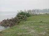
The lives of over one and half lakh inhabitants in Majuli, known to be the nerve centre of Vaishnavite traditions, coupled with a rich heritage of tribal culture are under grave threat due to the constant shrinking of its landmass owing to severe and unchecked erosion caused by the River Brahmaputra. This unique island which was originally formed due to the change of the course of the River Brahmaputra and its tributaries in medieval times has been ravaged by severe annual floods and erosion since 1950 when a great earthquake raised the bed of the river and caused massive destruction in Assam.
In fact, people of the island have been facing the problem of erosion from both the sides, namely the River Brahmaputra along its south bank and from the River Subansiri along its north bank. As of now, only 164 of a total 210 revenue villages have been spared by the river.
The land mass of the island has been reduced from 1256 square kilometres in 1950 to 514 sq. km in 1990, according to a letter written by the then Governor of Assam, Lt. Gen.(retd) Ajay Singh to the Prime Minister, on 27 June 2007. The letter further revealed that as per surveys, the rate of erosion is 7.4 sq. km per year. In 1901 the total geographical area was 1858 miles, with a population of 35,000. According to the 2001 Census, the island has a total population of 135,000. Now the population stands at around 169,000. According to statistics tabled before the floor of the Assam Assembly on July 2010, the present landmass of the island is 6,58, 528 bigha.
Between a period of 1972 and 2010 over 10,000 families have been displaced, most of them for several times, each time facing the same livelihood crisis. The worst sufferers are the Mishings, the tribals who traditionally prefer to live in riverine areas as their culture is deeply rooted to the flow of a river. The number of families displaced due to erosion varies between 38 and 564 each year.
“The displacement and submergence of our traditional land has not only affected our life and livelihood, but it has had a deep impact on our religion and culture as well,” says Lakheshwar Palo.
 Ironically, while the traditional settlements of Mishings people popularly known as noi-porias or river bank dwellers have been eroded by the river, the models of traditional dwelling houses of these tribal people which are built to cope with high floods, have become fashionable and income generating lodges and hotels for both the Department of Tourism and private entrepreneurs. The architecture of most of the government buildings and hospitals has also been developed on the pattern of these traditional dwelling-houses of the Mishings. The government borrowed the know-how of the Mishing tribe to protect government offices and other buildings from recurring floods. Ironically, the government has done little to protect thousands of erosion-affected tribal and non-tribal residents of the river island even though it has the know-how to check erosion. Hundreds of crores of rupees meant for anti-erosion and flood prevention schemes have been sunk and siphoned off through the nexus of a section of corrupt bureaucrats, contractors and politicians.
Decades of erosion has made the presence of displaced people easily visible in and around the entire island particularly on the slopes of both sides of the roads - cum embankments of the river island. As the number of these displaced people is huge and gradually increasing over the years, it is quite obvious that these people become easy targets of different development agencies- both government and non-government.
Although flood inundation and bank erosion are two major problems, the people living in the island consider floods a blessing at times, as flood waters often make agricultural land more fertile. Their safety was ensured as they have the know-how of constructing effective houses to cope with even high floods, passed and practiced from generation to generation. However, their bane has been the rapid loss of their villages and agricultural land due to erosion.
Cultural importance:
The erosion of land has posed a threat not only to riverine tribal bases but also to non-tribal villages and most particularly to Vaishnavite Sattras (monasteries). It is said that the great medieval Vaishnavite saint and social reformer Sankardev met his disciple Madhabdev in Dhuwahat the area of Majuli and set up the first Sattra there. The place is, however been eroded away a long time back. The Vaishnavite tradition during medieval periods including music, dances, and drama and related cults including musk tradition, medieval paintings, and manuscripts writing and paintings grew, nurtured and developed in the heart of these Sattras. Most of such unique institutions, which follow the Vashnavite tradition and culture strictly even today despite the threat of possible erosion and economic hardship, have to be either shifted as they are facing a serious erosion threat. The island which was once home to 64 such Sattras, now has only 22 such institutions as of today. The River Brahmaputra is now almost at the door step of Bengena Ati and Bhogpur Sattra.
Apart from being a cultural hotspot with a pure blend of both Vaishnavite, non-tribal and tribal cultural heritage, this river island is also an attraction for regular domestic and foreign tourists due to its rich avi-fauna that includes migratory birds, fresh-water river dolphins, turtles with numerous wetlands, isles and groves as well as wide-ranging floral species.
The erosion in different parts of the state is so acute that even the state government has from time to time expressed its inability to rehabilitate all of them properly. According to statistics tabled on the floor of Assam Legislative Assembly on December 8, 2009 altogether 4, 71, 380.88 hectares of land in the state has been eroded away by different rivers and their tributaries between 1999 and 2009. During this period erosion had affected 2, 65, 559 families.
Anti - erosion strategy:
 The anti-erosion technology to save the river island and its unique heritage primarily was the construction of embankments which was initiated since 1952. These embankments serve a dual purpose of road communication and protecting the affected villages. However, this had proved to be unsuccessful over the years. During 1996, the Flood Control Department of the Assam Government requested the Brahmaputra Board to prepare a Master Plan, and also carry out hydraulic studies to suggest suitable anti-erosion measures. Accordingly, the Brahmaputra Board prepared the Master Plan in March 2000, and based on the Master Plan the Board initiated an ambitious project at a cost of Rs.244 crores.
This amount was substantially curtailed and the Central Water Commission sanctioned Rs.87 crores in August 2003, to be spent on a number of different focus areas - survey and data collection, physical modeling, construction of embankments and permeable screens with RCC porcupines, and strengthening existing land spurs, and bank protection over three years.
Accordingly, the Board prepared its Master Plan titled ‘Protection of Majuli island from flood and erosion’ with an estimated cost of Rs.86.56 crore for the development of Majuli island for flood control, erosion control and drainage improvement which was approved by the Central Government in February 2004.
While the Board was busy in preparing its work the people living in the island are not at all happy with the progress of the work and with the methods of the anti-erosion measures.
“Despite the fact that the Board had erected RCC porcupine in many areas, the River came to us day by day and one day suddenly eroded our village” says Prafulla Payeng, another embankment dweller. Over 1800 families have been displaced and 1400 hectares of land have been eroded away by the river since the period the Brahmaputra Board had initiated the Master Plan.
Demand for inclusion of World Heritage sites of UNESCO:
The only hope for the people of Majuli is its inclusion in the list of UNESCO World Heritage Sites and the protection of this river island needs to be taken on a war footing or the day will not be too far when the rich mosaic of tribal and non-tribal culture and heritage of Majuli will be a thing of the past and go down in the chronicles of history.

