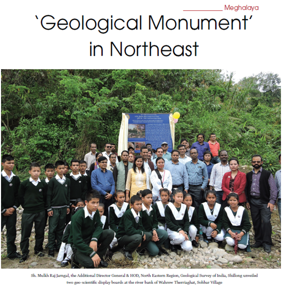
On 29th April 2019, Sh. Mulkh Raj Jarngal, the Additional Director General & HOD, North Eastern Region, Geological Survey of India, Shillong unveiled two geo-scientific display boards at the river bank of Wahrew Therriaghat, Sohbar Village and Mawmluh Cave in presence of Officers from District Administration, Mawmluh Cherra Cemented Limited (MCCL) Department of Tourism of Government of Meghalaya and local villagers and students. The display of these two boards with the Geo-Scientific Information (GSI) will help in creating awareness among the visiting tourists, students as well as the general public. The GSI took this step to polarize these two sites to educate the public and help them to preserve these places in order to conduct more studies regarding the climate changes around the globe.
Superintendent of GSI Paleontology Division NER Shillong, Debahuti Mukherjee said that the display has been put up in these sites for posterity and to be more aware of any geological events in the future. She added that the high presence of iridium in Therrighat is because of meteorite impact in the past which led to the mass human civilization extinction around the globe. She also said that the area has eminent evidence of being an ancient sea in the past as vast marine life fossils has been found in the area by GSI and other International Scientist.
Superintendent Geologist PRO of GSI NER Bashab Nandan Mahanta said that the stalagmite in Mawmluh cave has been tagged as Global Boundary Stratotype Section and Point (GGSP) which is the first formally ratified maker of a geological time period in India. He added that “this is a baby step towards the declaration of these two sites as ‘Geological Monument’ in the future”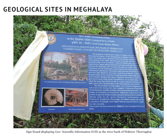
Meghalaya has a unique geological history that started more than 2000 million years back, went through significant geological events like breaking up from the ancient proto continent to submergence of some parts under sea and finally to give the world a geological age marker at about 4200 years ago.
Geological Survey of India is the premier organization that studies the various aspects of the earth forming processes and evolution of life from the ancient time. GSI is also the primary custodian of the rocks and fossils of the country which are a part of our natural heritage. GSI, North Eastern Region in its endeavor to popularize and publicize the geological history for the own people of Meghalaya and the rest of the world has taken up the work of installation of geological display boards at two important geological sites in Meghalaya.
The two geological sites are
Therriaghat: It is located near Sohbar village that marks the Cretaceous (K) - Palaeogene (Pg) mass extinction event. This site has already made the state famous to the international geological community and can be included in the tourism circuit as geo-tourism sites of the state. K-Pg boundary–Therriaghat:
Donboklang Wanniang
To read the further articles please get your copy of Eastern Panorama May issue @http://www.magzter.com/IN/Hill-Publications/Eastern-Panorama/News/ or mail to contact @easternpanorama.in
